SPECIALIST : Alat Selam - Alat Snorkeling - Diving Gear - Diving Set - Kursus Dive Course - Dive Center - Dive Shop - Service Alat Selam - Terra Tabung - Perahu Karet - Banana Boat - Rafting Boat - Mesin Kapal
- MASK
- SNORKEL
- FINS
- WETSUIT
- BOOTIES
- BCD & REGULATOR
- IST
- ZEEPRO
- BEUCHAT
- PROBLUE
- TUSA
- CRESSI
- GULL
- SEAC
- EPSEALON
- SALVIMAR
- IMERSION
- XDEEP
- DIVERITE
- DOLPHIN TECH
- RAZOR
- AQUATEC
- AROPEC
- PADI
- SCUBALAMP
- DIVEPRO
- WEEFINE
- SEALIFE
- BIGBLUE
- DIVEVOLK
- NAUTICAM
- SHEARWATER
- GARMIN
- BAUER
- FEELFREE DRY BAG
- SUNSCREEN
- CRUISER BOAT
- SPEARFISHING & FREEDIVING
MASK (S & F) SNORKEL (S & F) LONG FIN (S & F) SOCK (S & F) GLOVES (S & F) HOOD (S & F) SUITS (S & F) KNIFE (S & F) SPEARGUN POLE SPEAR PNEUMATIC GUN COMPOUND BOW FLOATING BUOY REEL SPEARGUN RUBBER SPEARGUN FOOT POCKET BLADE FIN CUSTOM SHAFT WEIGHT BELT ACCESSORIES FREEDIVING ACCESSORIES SPEARFISHING
- RENTAL EQUIPMENT
- COMBO SET
- MASK
FULL FACE - DIVE COMPUTER
- CAMERA
- TORCH
FLASHLIGHT - BATTERY
CHARGER - BAG
- FIRST AID
KIT - LIFE
JACKET - SWIMMING
EQUIPMENT - JUNIOR
EQUIPMENT - SNORKELING
ACCESSORIES - DIVING
ACCESSORIESGPS DIVING COMPASS DIVE ALARM HANGER REEL LIFTING BAG FLOAT & BUOY SAUSAGE (SMB) KNIFE & CUTTING TOOL WRITING SLATE STORAGE POUCH WEIGHT & BELT LANYARD & STICK POINTER CAP & HEAD COVERS PRESSURE HOSE HOSE ACCESSORIES REGULATOR ACCESSORIES OCTOPUS HOLDER OCTOPUS & DUST PLUG HOOK & SHOCK LINE D-RING & CLIP SILICONE GREASE THREAD ADAPTER HARDGEAR ACCESSORIES LINE MARKER - SERVICE & SPARE PART
ALL SERVICE FEE SERVICE TOOL TECHNICAL TOOL MASK SPARE PART BCD SPARE PART HOSE SPARE PART PRESSURE GAUGE PART O-RING SET INFLATOR BCD NEOPRENE GLUE WETSUIT & GEAR WASH 1ST STAGE SERVICE KIT 2ND STAGE SERVICE KIT CRESSI 1ST STAGE SERVICE KIT CRESSI 2ND STAGE SERVICE KIT ZEEPRO 1ST STAGE SERVICE KIT ZEEPRO 2ND STAGE SERVICE KIT IST 1ST STAGE SERVICE KIT IST 2ND STAGE SERVICE KIT BEUCHAT 1ST STAGE SERVICE KIT BEUCHAT 2ND STAGE SERVICE KIT DIVERITE 1ST STAGE SERVICE KIT DIVERITE 2ND STAGE SERVICE KIT
- TANK
- COMPRESSOR
- SCOOTER
UNDERWATER - MARINE
EQUIPMENT - SEAWALKER
EQUIPMENT - OUTBOARD
MOTOR - SOUVENIR
GIFT - BIG SALE
- WARRANTY TERMS
TESTIMONI


Office Number :
0361-4480056
FAST RESPONSE !!

0852-4018-8192
0895-4108-88762
0878-5225-2294
EMAIL :
operator.
balidiveshop
@gmail.com
(Order Only)
balidiveshop
@gmail.com
(Business Inquiry)
Jl. Bypass Ngurah Rai 17.A Sidakarya
Denpasar, BALI (80224)
(Lotte Mart - Traffic Light - 100M Left Side)
MONDAY - FRIDAY
09.00 AM - 06.00 PM
SATURDAY
09.00 AM - 05.00 PM SUNDAY
10.00 AM - 06.00 PM
Office Number :
0361-4480056
FAST RESPONSE !!

0852-4018-8192
0895-4108-88762
0878-5225-2294
EMAIL :
operator.
balidiveshop
@gmail.com
(Order Only)
balidiveshop
@gmail.com
(Business Inquiry)
Jl. Bypass Ngurah Rai 17.A Sidakarya
Denpasar, BALI (80224)
(Lotte Mart - Traffic Light - 100M Left Side)
MONDAY - FRIDAY
09.00 AM - 06.00 PM
SATURDAY
09.00 AM - 05.00 PM SUNDAY
10.00 AM - 06.00 PM
MASK
SNORKEL
BOOTIES
BCD & REGULATOR
IST
ZEEPRO
BEUCHAT
PROBLUE
CRESSI
SEAC
XDEEP
DIVERITE
DOLPHIN TECH
RAZOR
AROPEC
PADI
DIVEPRO
WEEFINE
NAUTICAM
SHEARWATER
GARMIN
FEELFREE DRY BAG
SUNSCREEN
CRUISER BOAT
SPEARFISHING & FREEDIVING
MASK (S & F)
SNORKEL (S & F)
LONG FIN (S & F)
SOCK (S & F)
GLOVES (S & F)
HOOD (S & F)
SUITS (S & F)
KNIFE (S & F)
SPEARGUN
POLE SPEAR
PNEUMATIC GUN
COMPOUND BOW
FLOATING BUOY
REEL SPEARGUN
RUBBER SPEARGUN
FOOT POCKET
BLADE FIN
CUSTOM SHAFT
WEIGHT BELT
ACCESSORIES FREEDIVING
ACCESSORIES SPEARFISHING
RENTAL EQUIPMENT
DIVE COMPUTER
CAMERA
TORCH
FLASHLIGHT
FLASHLIGHT
BATTERY
CHARGER
CHARGER
BAG
FIRST AID
KIT
KIT
SWIMMING
EQUIPMENT
EQUIPMENT
JUNIOR
EQUIPMENT
EQUIPMENT
SNORKELING
ACCESSORIES
ACCESSORIES
DIVING
ACCESSORIES
ACCESSORIES
GPS DIVING
COMPASS
DIVE ALARM
HANGER
REEL
LIFTING BAG
FLOAT & BUOY
SAUSAGE (SMB)
KNIFE & CUTTING TOOL
WRITING SLATE
STORAGE POUCH
WEIGHT & BELT
LANYARD & STICK POINTER
CAP & HEAD COVERS
PRESSURE HOSE
HOSE ACCESSORIES
REGULATOR ACCESSORIES
OCTOPUS HOLDER
OCTOPUS & DUST PLUG
HOOK & SHOCK LINE
D-RING & CLIP
SILICONE GREASE
THREAD ADAPTER
HARDGEAR ACCESSORIES
LINE MARKER
SERVICE & SPARE PART
ALL SERVICE FEE
SERVICE TOOL
TECHNICAL TOOL
MASK SPARE PART
BCD SPARE PART
HOSE SPARE PART
PRESSURE GAUGE PART
O-RING SET
INFLATOR BCD
NEOPRENE GLUE
WETSUIT & GEAR WASH
1ST STAGE SERVICE KIT
2ND STAGE SERVICE KIT
CRESSI 1ST STAGE SERVICE KIT
CRESSI 2ND STAGE SERVICE KIT
ZEEPRO 1ST STAGE SERVICE KIT
ZEEPRO 2ND STAGE SERVICE KIT
IST 1ST STAGE SERVICE KIT
IST 2ND STAGE SERVICE KIT
BEUCHAT 1ST STAGE SERVICE KIT
BEUCHAT 2ND STAGE SERVICE KIT
DIVERITE 1ST STAGE SERVICE KIT
DIVERITE 2ND STAGE SERVICE KIT
TANK
COMPRESSOR
SCOOTER
UNDERWATER
UNDERWATER
MARINE
EQUIPMENT
EQUIPMENT
SEAWALKER
EQUIPMENT
EQUIPMENT
OUTBOARD
MOTOR
MOTOR
SOUVENIR
GIFT
GIFT
BIG SALE
WARRANTY TERMS
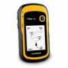
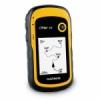
CLICK HERE -> H O M E ( BERANDA )|Bali Dive Shop Hp:087852252294|Importir,Supplier,Jual,beli,Distributor,Agen, Grosir,Toko,Price,Harga,Pusat,murah,online:alat selam/alat scuba/alat diving/alat snorkeling/alat snorkling/dive shop/dive course/dive » GPS AND FISH FINDER » GPS 73 Sea Garmin (Handheld)

Barang lain yang mungkin Anda cari:


-
 JeslynThanks balidiveshop.com, my order arrived and the goods are of high quality, I am from london and visited the island of bali, and search the internet, and it turns balidiveshop.com into the line of world diving equipment, great balidiveshop.com.
 -
ArabellaWhen I go to Raja Ampat, I want to dive and snorkel, then I search the internet and find the site balidiveshop.com after that I order online and goods arrive as I order with the same item is on the website, thanks balidiveshop.com
-
FeliceIf to bali, I immediately buy the equipment dive in balidiveshop.com, the place is comfortable, relaxed and complete again, wow cool
-
 Syarif ChandraSesuai pesanan. Pas sangat cocok. Sangat memuaskan
 -
MonikaPelayanan cepat, tanpa basa basi langsung kirim. Ngga kaya mantan yang cuma basa basi bawa kenangan :''''(
-
 ImeldaOne of the best dive shop in bali with affordable price. Reccomended...
 -
H. Badikmakasih barangx telah tiba pak bagus, aman. Satu2x agen online terpercaya
-
iZUL TUGUIRAPuas banget dgn kualitas barang. cepat nyampe. barang aman. Recomended banget. sukses terus Balidiveshop
-
FrenkyOwner-nya ramah, fast response, harga lebih murah dan barang ori. Thanks.
-
LulukResponnya cepat sehingga barang segera dikirim dan diterimadengan baik
Newsletter
Masukkan email Anda pada box dibawah untuk berlangganan informasi dari kami


